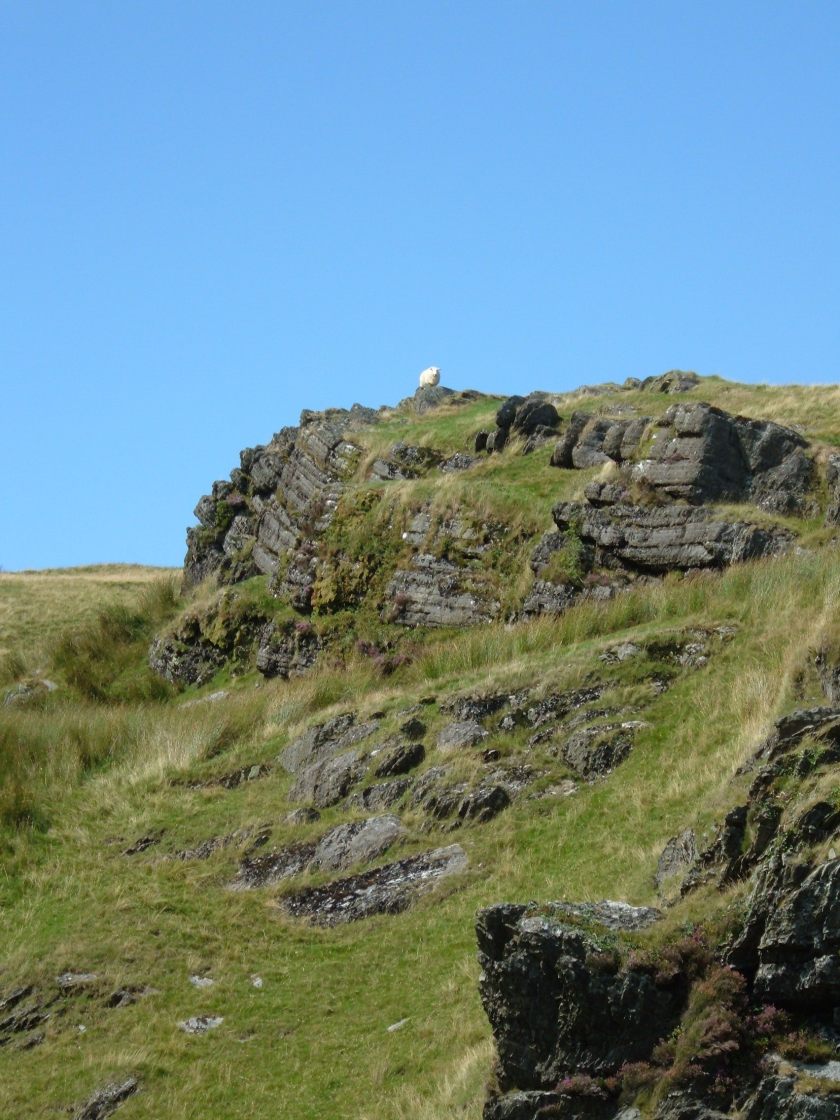
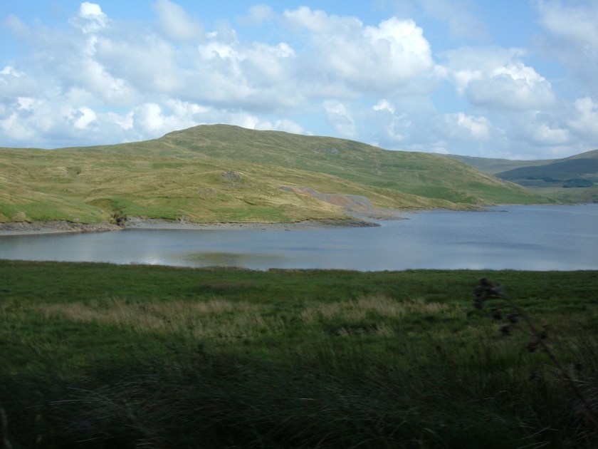
These pictures are from the left hand flank of Plynlimon, way North of us, just above the A44. but below Machynlleth. There is another reservoir/power station called Nant-y-Moch, very remote and inaccessible, absolutely no farms for miles, literally. But we did find a few sheep.
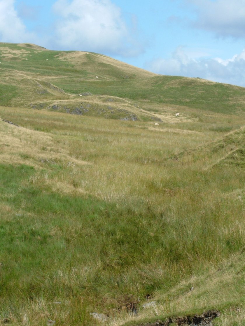
Much more bare up here, less forestry commission stuff especially on the tops. Not much soil. This is pretty typical, peneplaned old mountains ground down to stubs of their former selves.
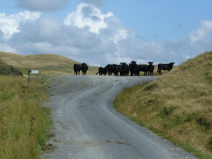
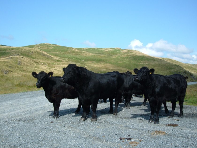
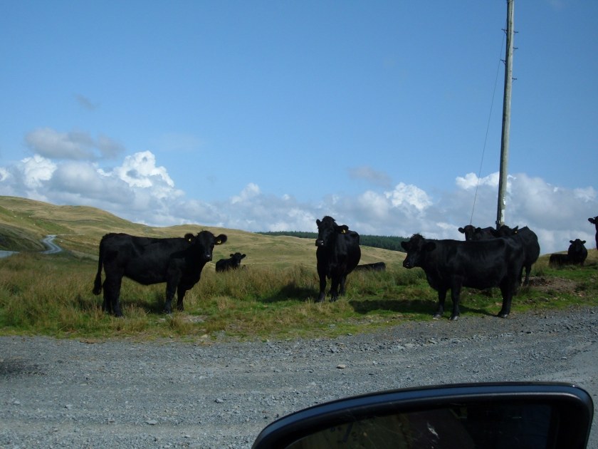
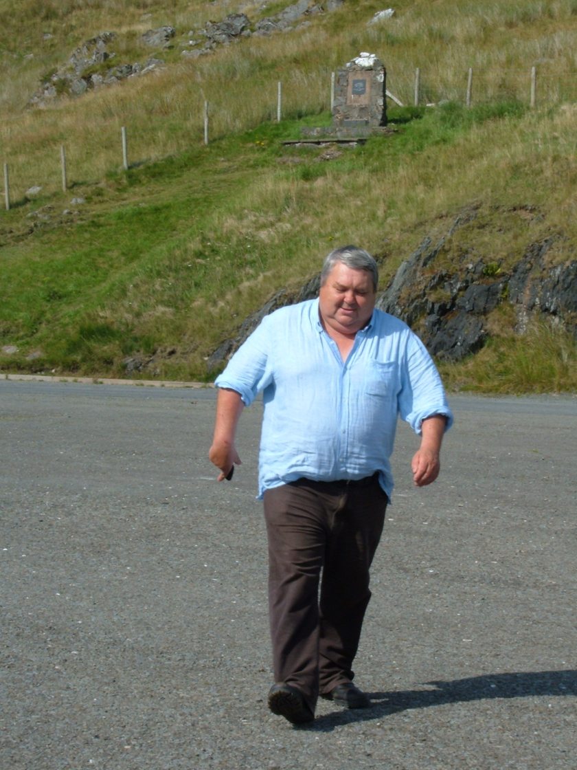
Oh ho! Now this was a turn up for the books. A herd of Angus beef cattle right smack bang in the middle of sheep territory! And just the right colour for an invading horde! Actually a very rare sight these days, very few people would graze their herds up here loose on the tops for fear of rustling. But as I said, this was a seriously remote area. What puzzled us was as to whom they belonged. There were no farms within miles so someone was having to come a fair way to keep an eye on them, which was obvious that they were, as they were in good condition. This was autumn and they would soon be taken down to the bottoms for winter pasture. it is too cold and snowy to leave anything up here.All got ear tagsThey were not happy to see us, especially in a big black 4×4, I think they thought we were going to challenge them so they got in fast. We beat a hasty retreat!Nant-y-Moch reservoirReal genuine sheep.Now then, there are two monuments here. In the foreground a farming friend of mine, as Welsh as Welsh can get and in the background a monument to a stunning event. We are actually in the car park of the Nant y Moch dam. The monument is to celebrate a pitched battle between Owain Glyndwr and English mercenaries in 1401 that happened on the southern flanks of Plynlimon a couple of miles from here. One wonders how 1500 mercenaries even got here. How they found each other to actually get round to having a battle and the Welsh won! Quite unheard of! The Welsh never ‘did’ set battles, not their style, more hit and run. 1500 men here is ridiculous, where did they come from? There are no towns of castles within dozens of miles. total bloody mystery. But it put Owain Glndwr firmly on the map as a rebel leader rather than a local bandit so to speak. Neither of us had ever heard of it before and laughed all the way to the pub.
Not that many sheep around. but one has to remember that no one leaves their breeding flocks up here for the winter. Unless the farmer has quite extensive pasturage flat round the farm, which is not generally available in hill country, the sheep go on their ‘hols’ to Pembrokeshire for the late autumn and early winter to eat someone else’s grass or fodder crops whilst they are carrying their lambs. Most of S Pembs is arable farming, sheep coming in are a cash sideline between crops. The sheep are shipped home before they start to lamb which keeps their home pastures in the best possible condition. Producing milk for lambs requires good nutrition, not worn out over eaten grass, and hay, beyond the limited quantity that can be made on a hill farm, is bloody expensive to buy. Which explains why at some times of year there are either no sheep or lots of them.
5 thoughts on “On the flanks of Plynlimon(Pumlumon Fawr)”
They’re like the All Blacks’ front row! And that farmer! I’m leaving! 😱
Good evening, CO.
Fascinating photographs of slightly upward inclines.
To be fair, it is a shame that Wales has never, ever, had anything approximating to a hill that was worth mentioning.
Moving on, thanks for your snaps of the prime beef that is the Angus breed.
Well at 2500′ no-one ever called it a mountain! The interesting thing is that peneplaned old mountains often do not have deeply dissected valleys except at the edges of the massif. Net result the whole thing can be really comparatively flat on the top. The other blog about Llyn Brianne has deeply dissected valleys as that is on the flanks of the southern edge of the old Hercynian chain. Quite different.
At that height the landscape still interacts with humanity, grazing, mining and forestry which is exactly what I like, a sense of involvement rather than an onlooker on the majestic..
Especially in 1401!
Hello Mrs. O. Regarding monuments thereabouts, close by your reservoir is the slate monolith marking the source of the River Hafren (Severn to the foreigners). Not far away is a strange slate slab marked 1865 with the letters WW carved beneath, I did have pictures (the old kind on paper not disc) and have spent the last few days searching for same (no luck). I have been told that the 1865 marker is a county boundary marker that originally was inscribed with the Date above the “Broad Arrow” (that universal sign of English oppression). Seems that way back in 186? a local chap (let’s call him William Williams) modified the original marking to reflect something more fitting.
Back to the USA, just over the hill are the remains of an American P-38 Lightning, the crash date 9/11……….1945 that is. The high valleys are still used for low altitude training by the RAF.
LW never have heard of that marker, but it is a bit further North I would have thought, must follow it up.
Must be an old marker between Montgomery and Merioneth. Probably complaining that Montgomery was under too much English influence just like Monmouthshire.!!
Interestingly they use the Towy valley for the same low flying training. I have a farming friend who has a farm on the side wall, the house and yards are right on the top and the land goes all the way to the bottom, with a clear view of the Brecon Beacons. Somewhat disconcerting to see to see huge cargo planes from above by a couple of hundred feet! One can see the pilots and wave hello.
Needless to say the amount of stock damage can be pretty bad if they fly too low but the military never complain at sending the cheques in compensation. Sometime they get it wrong and are skimming the trees! Sheep will skitter so but then who wouldn’t?